RURAL DEVELOPMENT ACTIONS: TERRITORIAL ANALYSIS AND DIAGNOSTIC, FORMULATIONS OF PROPOSALS
|
Description |

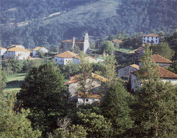
Rural landscape in a Mediterranean forest.
Through a system of territorial integrated analysis, which includes the treatment of documentary and cartographic information and fieldwork, an assessment of territorial structures and dynamics is performed to offer specific guidance, suited to specific cases that facilitate the application of grants for the enhancement of natural and cultural resources under the Rural Development Programme 2014-2020 co-funded by the European Union and in the future programming period 2021-2027.
The technology of analysis and territorial diagnosis and development proposals is applied with a systemic approach, aimed at developing the multifunctionality of rural areas.
|
How does it work |
Based on a proposal or will of certain action (such as support economic activity and employment diversifying the productive structure, promote the conservation and enhancement of natural resources, prevent natural hazards such as forest fires and restore affected areas; facilitate social organization and the development of territorial governance mechanisms; clean up ownership structures and promote competitive operating structures), it proceeds to perform the following tasks:
- Collection and analysis of legislative provisions and relevant legal documents for the preparation of applications for rural development action.
- Collection of documentary and cartographic information relevant to the management of the measure: territorial, economic and environmental variables.
- Fieldwork: recognition and evaluation of territorial capital and human resources.
- Computer processing of spatial information using a Geographic Information System.
- Application of technical evaluation indices (landscape, ecological, productive, social) to determine the orientation of the management model, assessing technically the feasibility and desirability of the proposed action raised or executed.
|
Advantages |
The analysis system offered has the advantage that its approach and development is based on academic and professional proficiency that guarantee 30 years of experience in the field, through national and international research projects, where networks of interdisciplinary cooperation have been established. The development of applied research projects has allowed the experimentation in very diverse regional ambits and at different scopes, allowing acquire a comprehensive and strategic vision. It has been also establish channels of communication and collaboration with government at European, national, regional and local level, which have generated a climate of professional confidence.
Professional training and work context are a guarantee of feasibility and risk reduction, and constitute a cosigner for consistency and solvency of the proposed rural development that individuals or the Administration submitted to apply for grants under national or regional programs for rural development.
|
Where has it been developed |
This scientific offer is the result of a line of research that has been developed since 1997 in the Department of Geography at the Complutense University of Madrid. The Geography, Policy and Forestry socioeconomics research group has an extensive experience in applied research on the accompanying of the Common Agricultural Policy reform, and especially on defense actions against forest fires and programs afforestation of agricultural land. This experience has allowed us to establish contact with the technicians responsible for the implementation of measures of Community policy in the regional and central governments and meet the real needs of practicality in the subject, as well as aspects that interest and concerned individuals interested in taking these measures. The team has a strong interdisciplinary character: it involved specialists geographers in regional geographic analysis and GIS, as well as environmentalists and experts in rural development. To the value of the interdisciplinary team, which enables complete the territorial perspective of geographers with the technical vision of environmentalists, is necessary to add the integration into national and international networks specialized in the field.
Department: Department of Geography
Research Group: Geography, politics and forestry socioeconomics
|
And also |
The services offered may be proposed at different levels (regional, local, private farm) and be of interest to institutional recipients (regional and local government) responsible for the implementation of rural development programs, and individuals (holders of agricultural and/or forestry land interested in benefiting from assistance).
|
Contact |
|
© Office for the Transfer of Research Results – UCM |
|
PDF Download |
|
Classification |
Political Science and Sociology
|
Responsible Researcher |
Cristina Montiel Molina: crismont@ghis.ucm.es
Department: Geography
Faculty: Geography and History


