Nuevo artículo: Combining high-resolution tessellations and detailed transport networks for accessibility analysis in large areas: indicators of human pressure on coastal areas
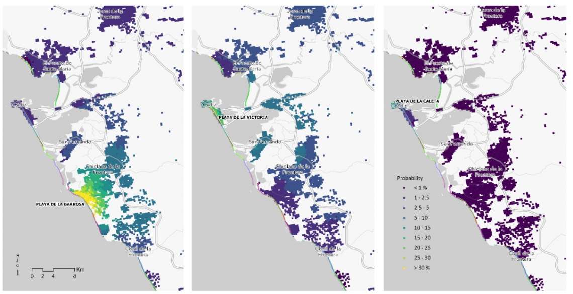
Investigadores de tGIS y de la Universidad de Sevilla presentan su estudio sobre la presión humana a las playas de Andalucía según su accesibilidad territorial
30 jul 2024 - 14:32 CET
Autores: Borja Moya-Gómez, José Ojeda-Zújar, Juan Carlos García-Palomares, Juan Pedro Pérez-Alcántara, Javier Gutiérrez Puebla, y Esperanza Sánchez-Rodríguez
Resumen / Abstract:
Human pressure on coastal areas poses a serious threat to their conservation. This pressure can be measured using accessibility indicators. However, a detailed accessibility analysis, with highly spatially disaggregated information and complex transport networks, requires millions of optimal routes to be obtained. To reduce processing times, this paper uses the centroid of a regular tessellation representing trip origins (square tiles with population and average income) and a layer of points associated with the coastline to represent destinations. Route calculations between all origins and all destinations are performed once, and then, depending on the objective of the study (accessibility to ports, beaches, lighthouses, or other points of interest), optimal route selections to the corresponding destination type can be made. The study results show the different degrees of human pressure on Andalusian beaches using different accessibility indicators.
Enlace: https://geofocus.org/index.php/geofocus/article/view/843
¿Cómo citarlo? Moya-Gómez, B., Ojeda-Zújar, J., García-Palomares, J. C., Pérez-Alcántara, J. P., Gutiérrez Puebla, J., and Sánchez-Rodríguez, E. (2024). Combining high-resolution tessellations and detailed transport networks for accessibility analysis in large areas:indicators of human pressure on coastal areas. GeoFocus, Revista Internacional de Ciencia y Tecnología de la Información Geográfica, 33,27-42. https://doi.org/10.21138/GF.843

